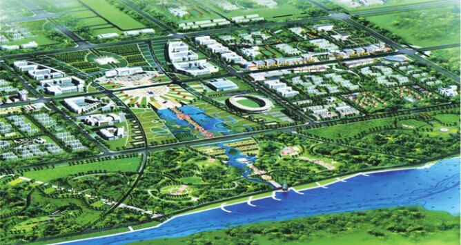
| ALAER CITY SITUATION? 行政区域:面积6930平方公里,总人口30万。 地理特征:地处天山南麓,新疆南部,冰雪融化孕育的阿克苏河、叶尔羌河、和田河,三条逶迤南疆的姐妹秀河,在阿拉尔牵手相会,为名扬五洲的塔里木河慷慨送行。塔河源头,长流不息,她穿市而过,飘逸东去,一路风光,靓丽无限。 统筹布局:构筑阿拉尔“一河两岸、一轴三组团”的城市发展体系,形成以城市中心为轴线,塔河两岸、南北市区同步发展,以开发区为主体的工业组团、塔里木大学文化产业组团、塔里木河两岸现代农业组团发展的新格局。 Administrative region:covering an area of 6, 930 square kilometers, with total population of 300, 000. Geographical features:Located in the south foot of Tianshan Mountains and the sorthern Xinjiang, the snow and ice birthed Aksu River, Yarkand River and Hotan River-the three sister-liked beautiful rivers are winding along south Xinjiang and gathered in Arar as if seeing off the worldwide well-known Tarim River generously. The source of Tahe, streaming endless, which goes through the city and flows eastward, all the way, companied with the beautiful boundless scenery. Overall layout:building urban development system of "one river with two banks and one shaft with three groups” in Arar, forming new development pattern of synchronous development between north and south urban areas by taking the city as center axis and the industry groups with industrial development zone as the main body, Tarim University Culture Group and Tarim River Modern Agriculture Group.  ? |